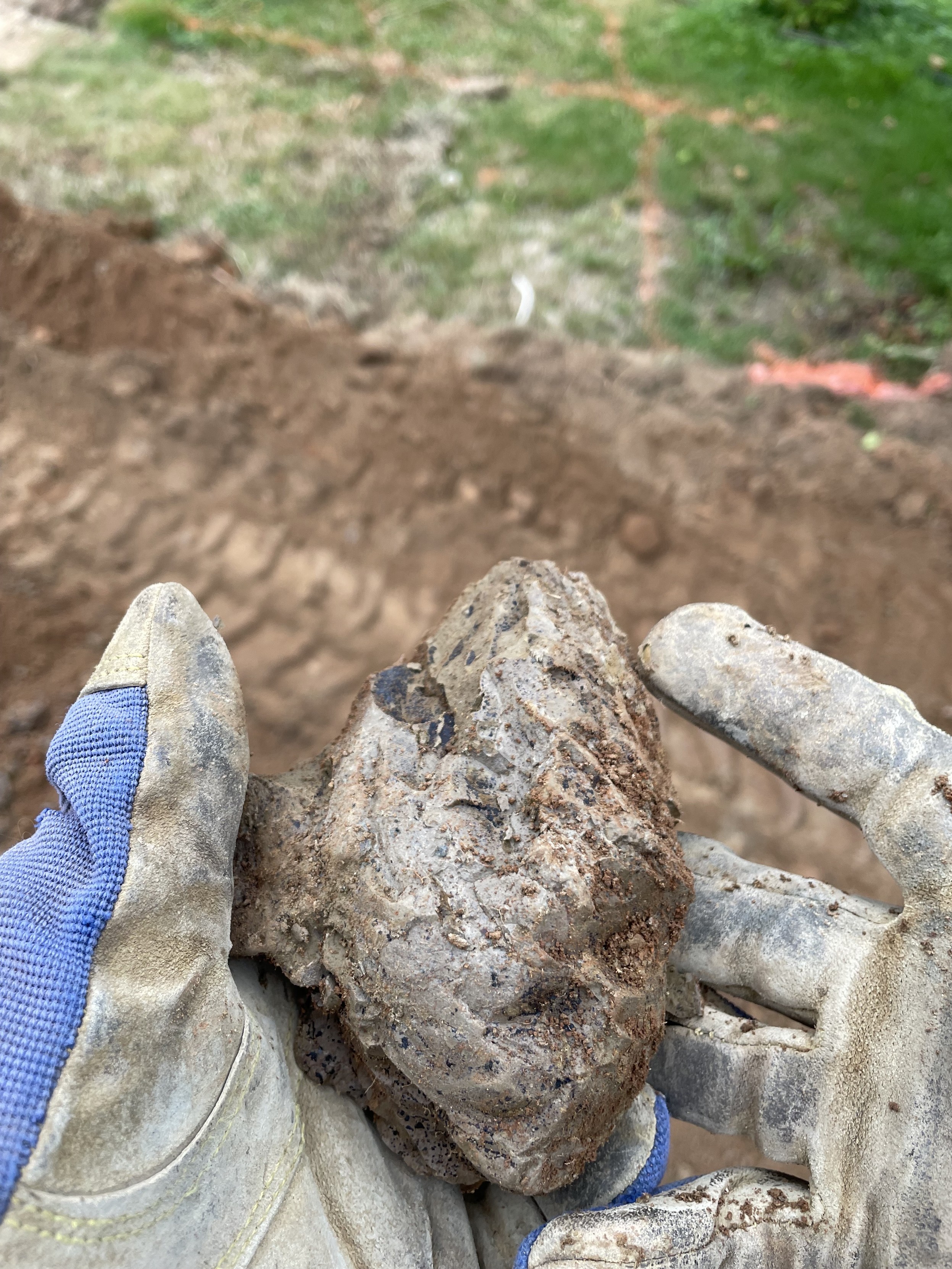
Hey #GeologyMastodon may I get an assist in identifying this rock?! I believe I have hit bedrock about 1 metre down in my #BackyardProject #PoolPond excavation.
-
Chris Alemany🇺🇦🇨🇦🇪🇸replied to Mat Wright last edited by
@MatWright lol. rebel!
-
@MatWright @chris Well, I see no layers option. I guess that's what they've done. My Local Muni ARCgis never asked for account details. Mineshafts should be somewhere on their ARCgis
-
David Mitchell :CApride:replied to Chris Alemany🇺🇦🇨🇦🇪🇸 last edited by
No expertise to share but following curiously… what does it look like when it’s dry?
-
Chris Alemany🇺🇦🇨🇦🇪🇸replied to David Mitchell :CApride: last edited by
@DavidM_yeg it is grey (see next reply in thread, just putting it up now). Someone mentioned mudstone or siltstone and I think that makes sense.
-
Chris Alemany🇺🇦🇨🇦🇪🇸replied to Chris Alemany🇺🇦🇨🇦🇪🇸 last edited by
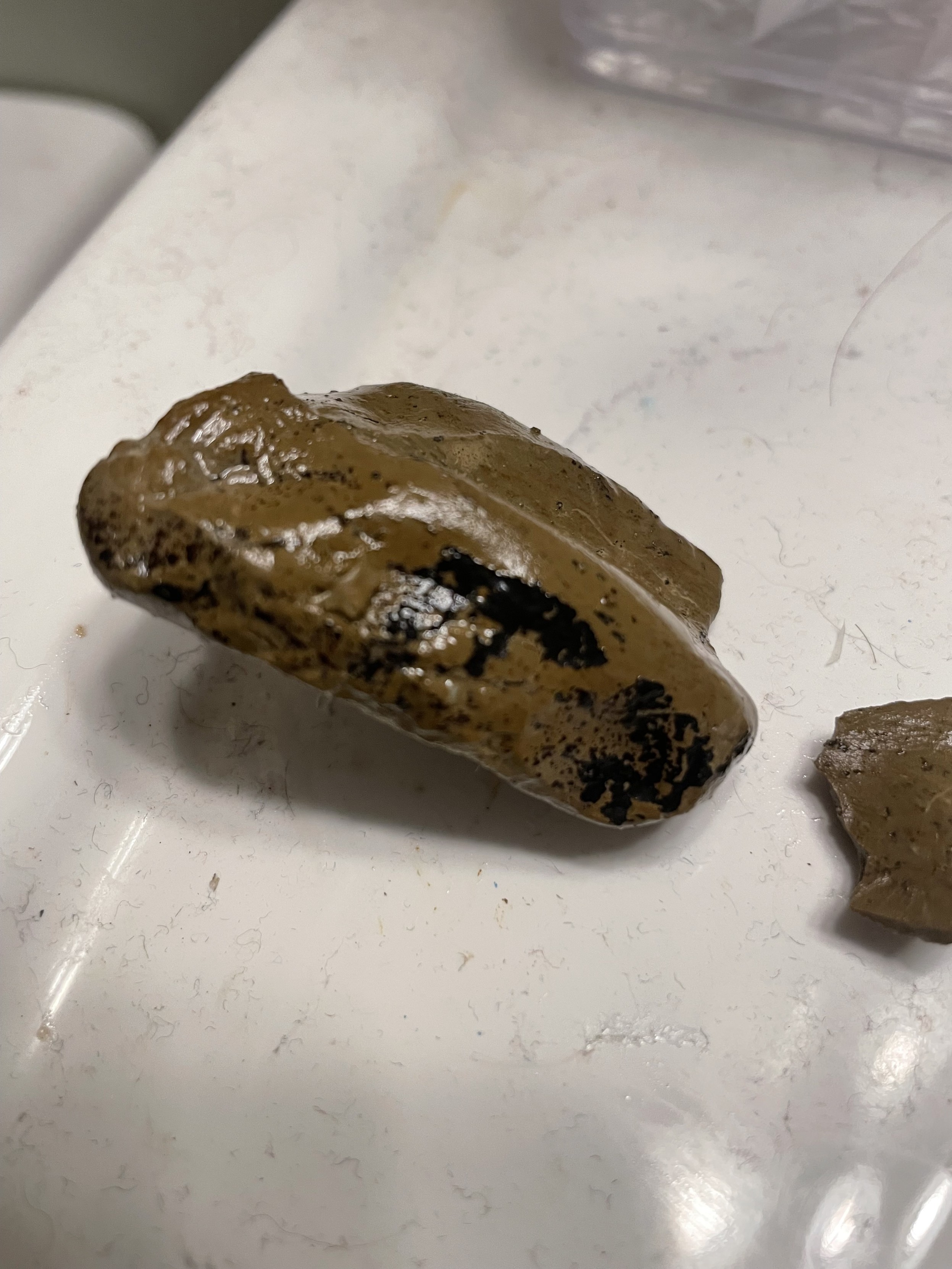
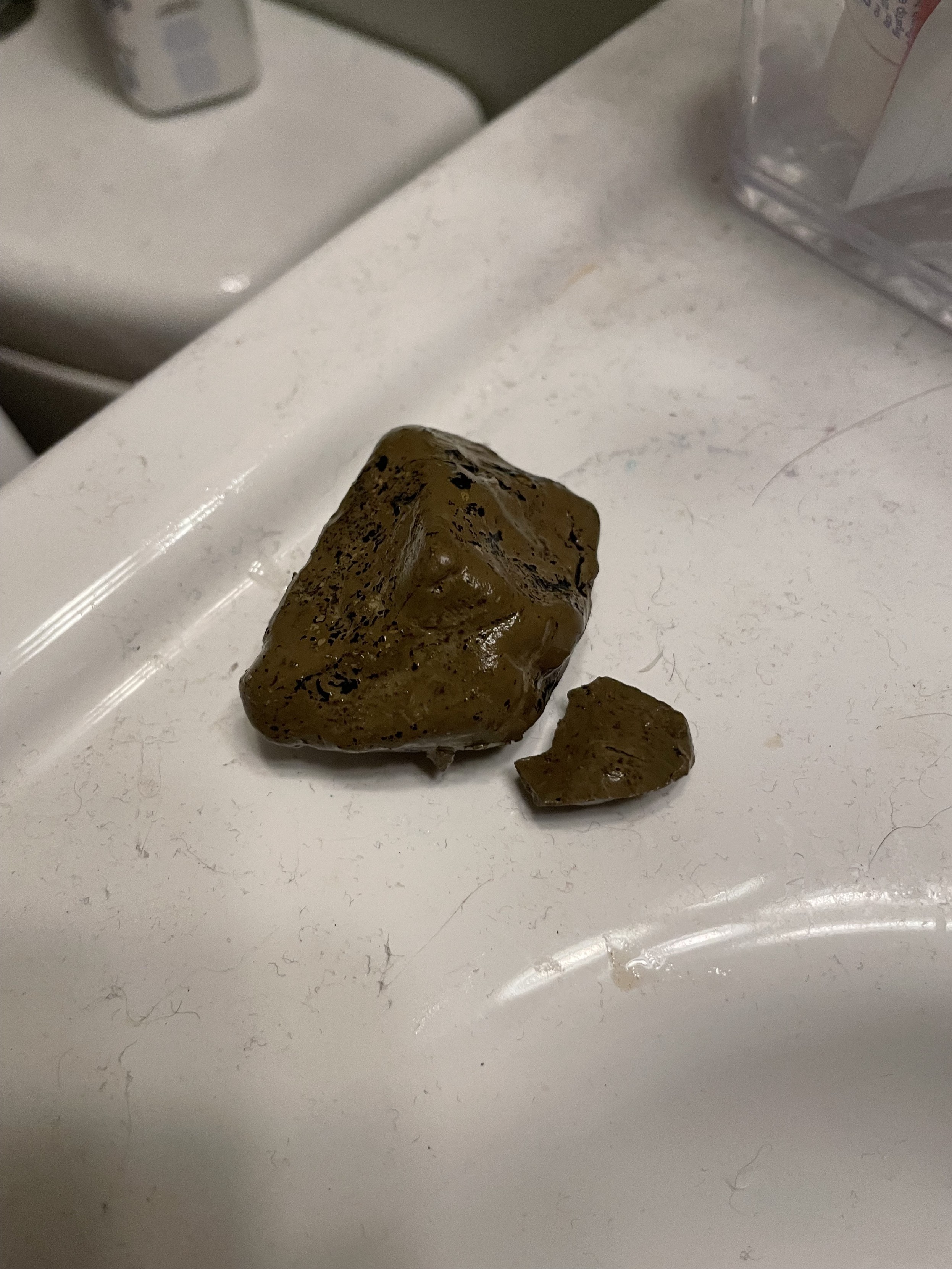
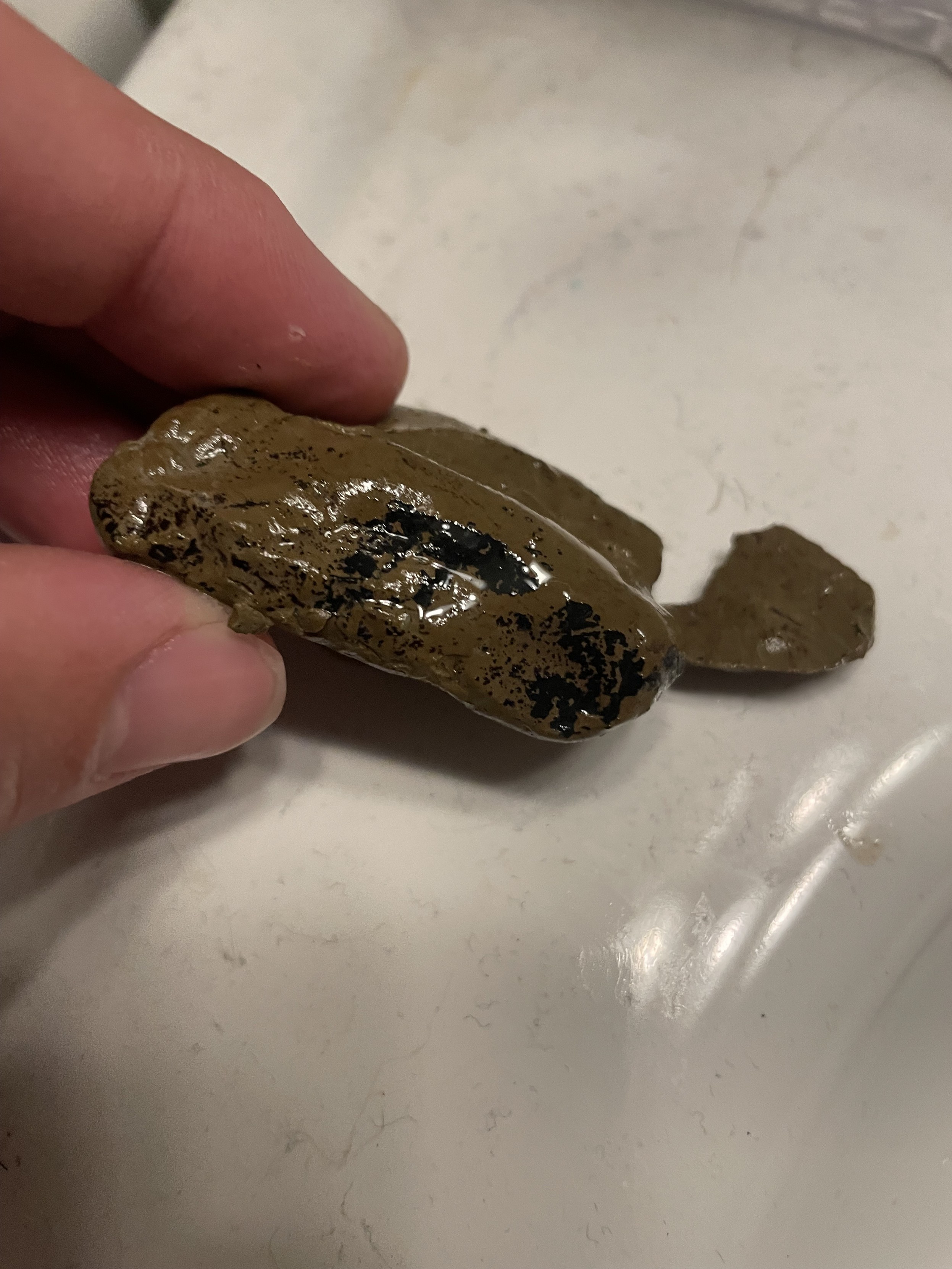
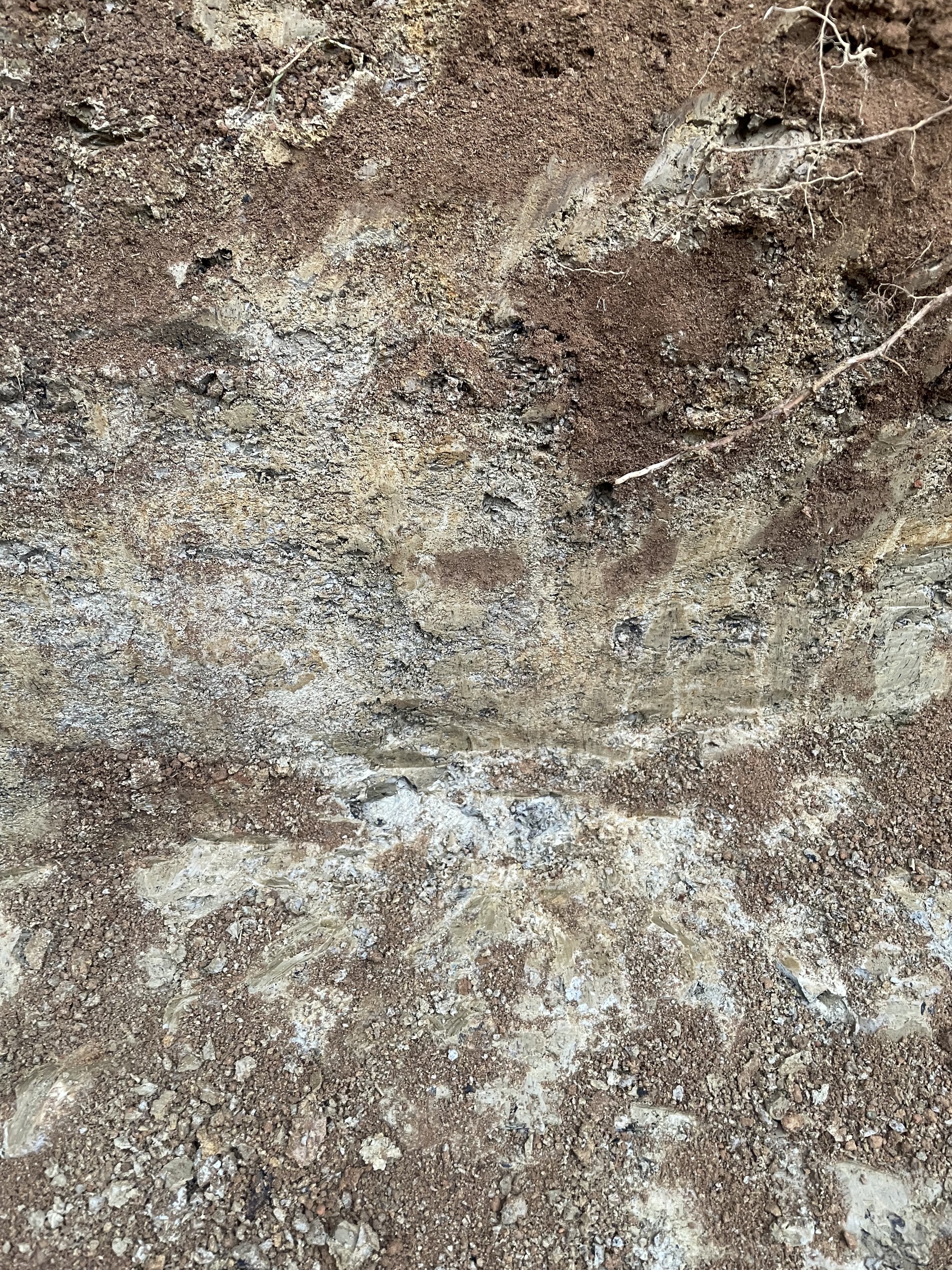
Someone suggested mudstone or siltstone. This seems right to me. The more I dig and scrape away at it the less I think it is some sort of old fill. When it is dry in the hole it is grey. There are lots of flecks and shards of carbon-like black stuff. But mostly it is grey, crumbly when knocked around, rock.
Here is this morning's look in the hole.Whatever it is, it is too much for this digger to dig through efficiently.
#GeologyMastodon #BackyardProject #PoolPond #VancouverIsland #PortAlberni #Geology #Rocks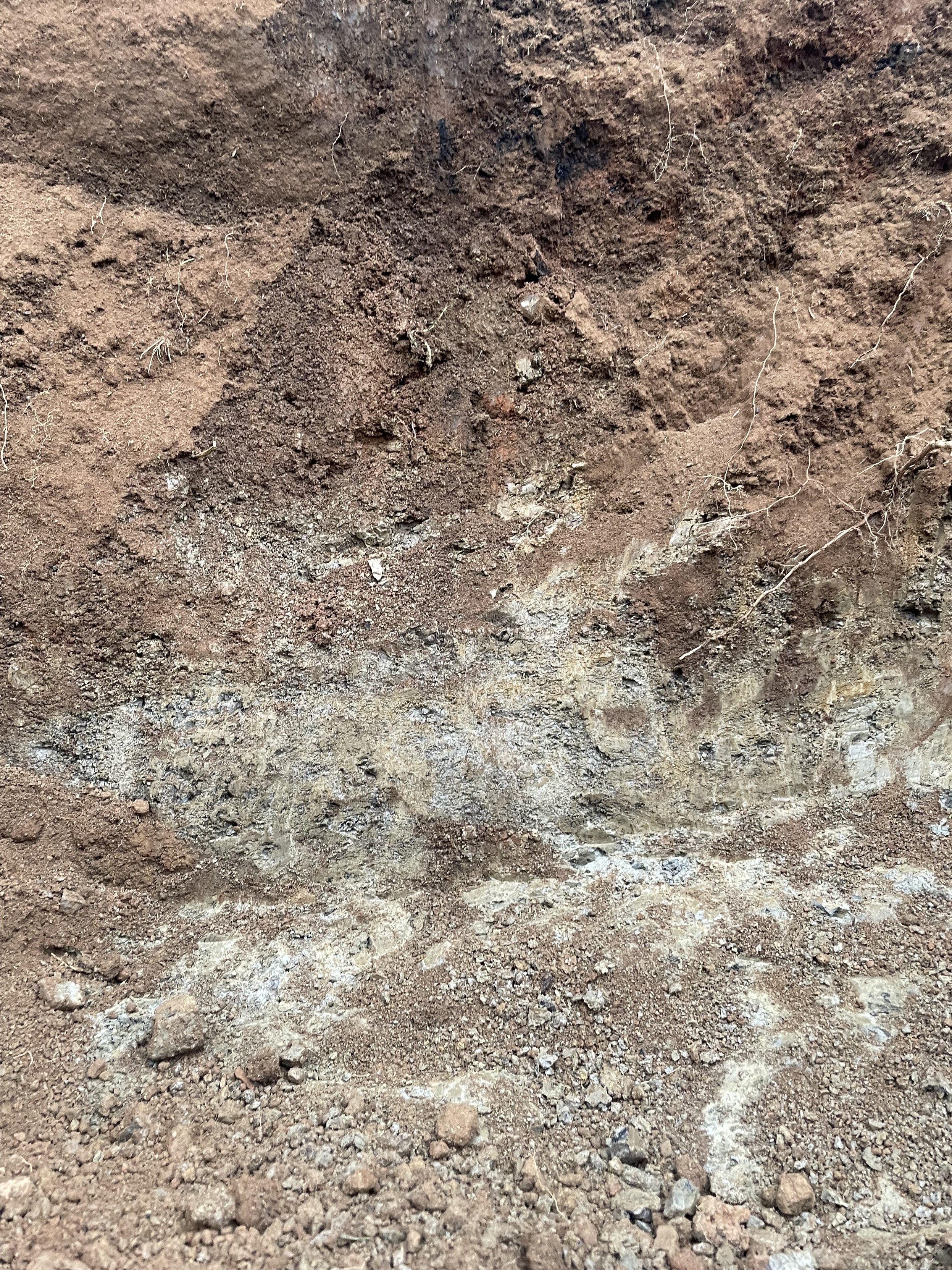
-
Chris Alemany🇺🇦🇨🇦🇪🇸replied to Chris Alemany🇺🇦🇨🇦🇪🇸 last edited by
In other news, I have already put just under 8 hours on the machine and only dug one of three holes! I guess I am paying for another 8hrs! #GeologyMastodon #BackyardProject #PoolPond #VancouverIsland #PortAlberni #Geology #Rocks
-
Maria-Katriina Lehtinenreplied to Chris Alemany🇺🇦🇨🇦🇪🇸 last edited by
@chris At an experienced guess, weathered and rubbly siltstone of the Haslam Formation (Upper Cretaceous, Nanaimo Group).
Source: my geological mapping of the Alberni Valley and Beaufort Range, ca. 1991.
-
Bob Downiereplied to Chris Alemany🇺🇦🇨🇦🇪🇸 last edited by
@chris A good place to start for geology information is an online geology map. Perhaps this one will help? Navigate to your location and touch the locality for a summary. What does it tell you?
-
martin_fffreplied to Chris Alemany🇺🇦🇨🇦🇪🇸 last edited by
@chris thought you said you were digging in clay? Looks more like limestone at the bottom.
-
Chris Alemany🇺🇦🇨🇦🇪🇸replied to Maria-Katriina Lehtinen last edited by
@mariakatriina cool! I'll definitely take that as an authoritative answer! Thank you!
-
Chris Alemany🇺🇦🇨🇦🇪🇸replied to Maria-Katriina Lehtinen last edited by
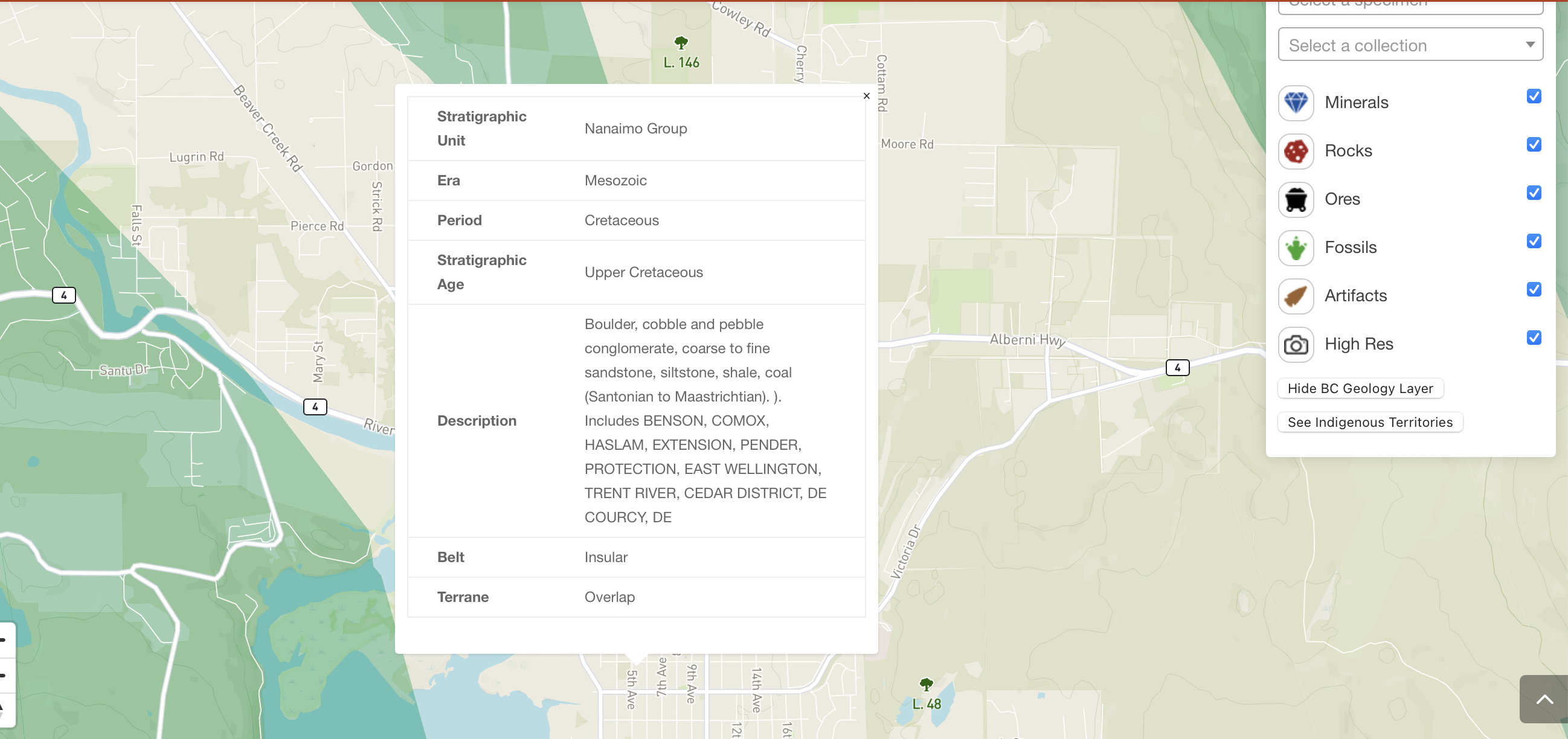
@mariakatriina This mapping confirms your mapping/classification as well! H/t @geomannie
"Nanaimo Group”
Era: Mesozoic
Period: Cretaceous
Stratigraphic: Age Upper CretaceousDescription: Boulder, cobble and pebble conglomerate, coarse to fine sandstone, siltstone, shale, coal (Santonian to Maastrichtian). ). Includes BENSON, COMOX, HASLAM, EXTENSION, PENDER, PROTECTION, EAST WELLINGTON, TRENT RIVER, CEDAR DISTRICT, DE COURCY, DE
Belt: Insular
Terrane: Overlap”
-
Chris Alemany🇺🇦🇨🇦🇪🇸replied to martin_fff last edited by
@martin_fff Clay on top, but the bottom is this stuff. Experienced eyes are saying siltstone.
-
martin_fffreplied to Chris Alemany🇺🇦🇨🇦🇪🇸 last edited by
@chris looks porous as heck. assuming your pond will have a liner.
-
RealGravitasreplied to Chris Alemany🇺🇦🇨🇦🇪🇸 last edited by
@chris Your basement map is pretty non-specific. Jurassic-Neogene is about 100 million years spread, so it doesn’t offer much clue.
Soil development is a complex process, and you could be dealing with a highly indurated soil faces. You’ll probably want to run a test hole if you’re trying your decide whether to go deeper. It could be, as you suggest, a transition to underlying bedrock, or just a thin indurated soil horizon over softer material.
Typically, basal soil horizons will contain chunks of the underlying bedrock. If you don’t see that, you may have more soil layers. (This one looks bleached.)
One test you could perform on this material is to soak a chunk of it overnight. If it falls apart, it’s more sandy-silt. If it holds together and becomes plastic, it’s mostly clay. -
Chris Alemany🇺🇦🇨🇦🇪🇸replied to martin_fff last edited by
@martin_fff yup!
-
Chris Alemany🇺🇦🇨🇦🇪🇸replied to RealGravitas last edited by
@CWilbur thanks. That's great info! I won't have time to run the experiment AND dig, but I have plenty of digging to do anyway today before I have to give the machine back. So I'll try out that out just for fun tonight.
Maria-Katrina provided a more specific classification but like you said, it's hard to know if this is truly the basement or a layer.
Maria-Katriina Lehtinen (@[email protected])
@[email protected] At an experienced guess, weathered and rubbly siltstone of the Haslam Formation (Upper Cretaceous, Nanaimo Group). Source: my geological mapping of the Alberni Valley and Beaufort Range, ca. 1991.
The Wandering Shop (wandering.shop)