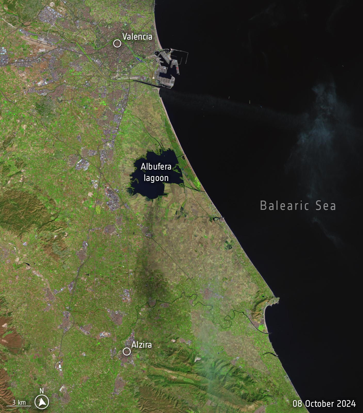
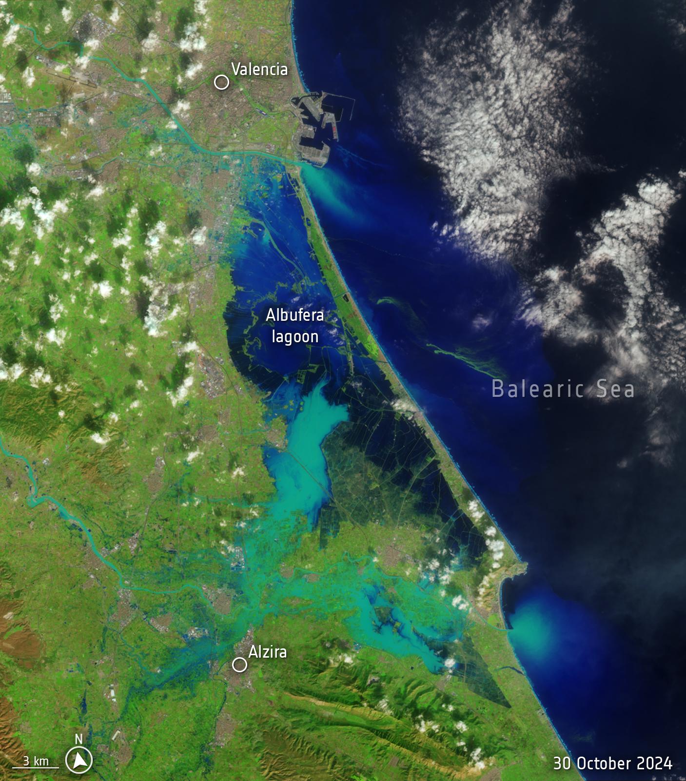
A mindblowing set of images of what the flood in #Valencia looks like from space - images of the same region from 8 and 30 October (I've been to the area, this is scary)
-
A mindblowing set of images of what the flood in #Valencia looks like from space - images of the same region from 8 and 30 October (I've been to the area, this is scary):
 ️ https://www.esa.int/ESA_Multimedia/Images/2024/10/Valencia_flood_disaster
image credit: USGS, processed by #ESA
images from the US Landsat-8 satellite -
Bruno Girinreplied to Dr. Victoria Grinberg last edited by
@vicgrinberg wow! I was there on the 8th!
The big flooded area is the Albufera national park around the lagoon which is not built up and acts exactly as it should as a flood plain. It could have been a lot worse if that area hadn't been a protected nature reserve!
-
@vicgrinberg additional information about what you see in this picture: the blue line on top that flows into the sea is river Turia. It used to go through the centre of Valencia and its course was diverted after the deadly flood of 1957. This time round, it broke its banks but the damage was limited to the motorway and the fields alongside it: the diversion did its job and probably saved 1000s of lives.
1/?


